Saadian Empire Map 1590 - Historical Map of The Saadi dynasty of Morocco
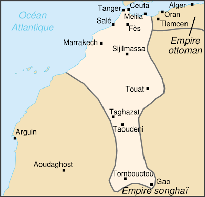
Between 1555 and 1659, there was a very poweful empire in todays Morroco; Saadian Empire or as their common mame The Saadi dynasty. They ruled Morocco from south to the north. This map shows extent of the Saadian Empire during the reign of Ahmad al-Mansur . Its dated 1690. As we see on the map; Tombouctou, Taghazat, Taudeni, Sıjilmasa, Melila, Fes, Marrakech were some of the main towns of the Saadian Empire . Eflatun Pınar, A Hittite Sacred Spring. An ancient pool in Turkey, aboyt 4000 years old!


