Posts

Showing posts from February, 2014

Hunger Map of Europe 1918

Image
Hunger Map of Europe.  Have you ever seen Europe in hunger before? This map shows the hunger levels for the Europe in 1918. It was in an article published first in the newspaper, The New York Times Current History Magazine for the April-May-June 1919 99 Years later.. No more Hunger in Europe; Now the young Europeans are enjoying a good life.. like in this bar

Anatolia in 1325 - Turkish Principalities 12th Century

Image
Turkish principalities (Turkish Beyliks) after Mongols defeated the Seljuk Turks at the Battle of Köse Dağ in 1243.  This historical map represents the situation around 1325. Aydinids, Karasids, Sarukhanids , Menteşe, Ottomans, Germiyanids, Hamidids, Beylik of Teke, Isfendiyarids, Chobanids, Karamanids, Eshrefids, Beyliks of Canik, Eretnis, Beylik of Dulkadir, Ramadanids, Beylik of Dulkadir.

Afrika Ülkeleri Haritası

Image
Güncel Afrika haritası . Afrika ülkelerini gösteren harita.

Africa 2014 Map

Image
Africa is a continent that its maps have been changing for centuries so often. This is African countries map 2014.

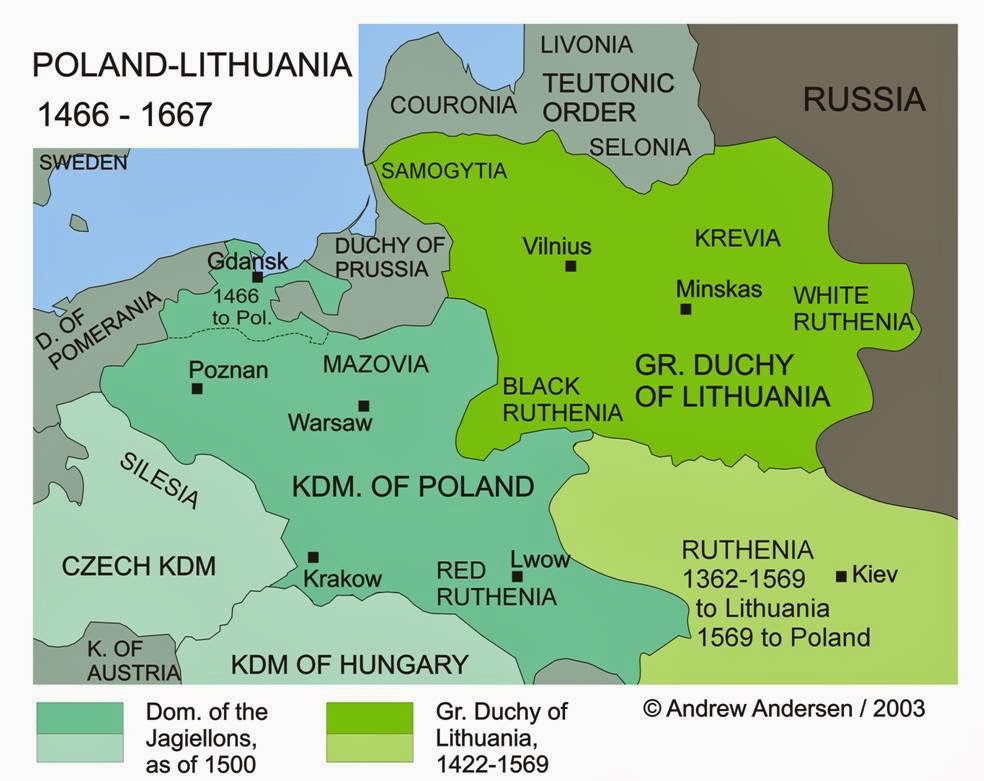
The Polish-Lithuanian Commonwealth 1466 - 1667

Image
Map of the Polish Lithuanian Commonwealth and Kingdom of Poland , Grand Duchy of Lithuania , Ruthenia , Duchy of Prussia In 1569, the Lublin Union united Poland and Lithuania as the Polish-Lithuanian Commonwealth . The Polish-Lithuanian Commonwealth installed an "interstate federal union based on common institution" (Lerski 622). This meant that kings were elected jointly, but the legal systems and administrations remained separate. The states acted as a single entity in external affairs.

Popular posts from this blog

Sibirya

Map of Crusades and Cities on Routes

Map of Roman Empire 300 A.D

Hunger Map of Europe 1918

Search This Blog