Ancient Map of The Middle East 1450 B.C - The Orient about 1450 B.C


Who were living in Middle East 2,500 years ago?

An interesting historical map that shows us how the Orient looked like in very ancient times.
Egypt Empire, Babylonia, Assyria, Phoenician settlements, Mycenean civilisation.

Ancient Map of The Middle East
Courtesy of the University of Texas Libraries

Popular posts from this blog

Greek Colonization of Western Asia Minor 11th-18th Centuries B.C

Map of Roman Empire 300 A.D

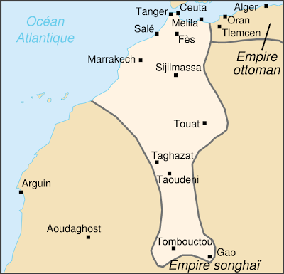
Saadian Empire Map 1590 - Historical Map of The Saadi dynasty of Morocco

Popular posts from this blog

Sibirya

Map of Roman Empire 300 A.D

Map of Crusades and Cities on Routes

Hunger Map of Europe 1918

Search This Blog