Map of Ancient Mesopotamia and Egypt 1450 BC

A detailed map of Ancient Mesopotamia 1450 BC


The borders of Hittite Empire, Mitanni State, Assyria, Babylonia and Egypt . You can also see the major cities of that times; Nineveh, Assur, Susa, Babylon, Tyre, Troy, Thebes, Nubia and Memphis.

Map of Ancient Mesopotamia and Egypt 1450 BC

Popular posts from this blog

Greek Colonization of Western Asia Minor 11th-18th Centuries B.C

Map of Roman Empire 300 A.D

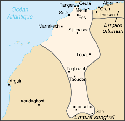
Saadian Empire Map 1590 - Historical Map of The Saadi dynasty of Morocco

Popular posts from this blog

Sibirya

Map of Crusades and Cities on Routes

Map of Roman Empire 300 A.D

Hunger Map of Europe 1918

Search This Blog